
Memory Lane: Lexington’s Past On The Road
Original Route 4/66 & Oasis Drive-In Sign on Memory Lane, Source: Illinoisroute66.org
Memory Lane Sign, Source: Illinoisroute66.org

Memory Lane in Autumn, Circa 2024, Source: Seigo Saito via Facebook
Memory Lane: Lexington's Past On the Road
Before there was a Route 66 or a paved road of any kind, there was a trail running through the glacial prairies of central Illinois. Worn into the landscape by the hooves of cattle and hogs, the boots of travelers, and the wheels of supply wagons, the old Chicago-to-St. Louis road was the economic lifeline of central Illinois. In 1831, only two years after Patton Cabin cleared space in the wilderness, local innkeeper Jacob Spawr petitioned the courts to bring that trail through what would become Lexington, and for the better part of two centuries, that road kept running right through the heart of town, eventually becoming the famous Route 66. Today, visitors can see an original stretch of The Mother Road as it was laid out 100 years ago on Memory Lane. This recreation area is one of the few places in the State of Illinois to take in America's highway history preserved in time.
From Cattle Trail to Mother Road
The road that would become Memory Lane evolved slowly, shaped by each generation's need to move faster and farther. By 1915 it was an unpaved stretch known as the Pontiac Trail. By 1918, Illinois voters had a hand in transforming it: with a growing population and a post-war economy to rebuild, Illinois residents passed a $60 million state bond issue for road construction that designated the corridor as State Bond Issue Route 4. Federal action followed. The Federal Aid Road Act of 1916 had provided $75 million over five years for matching funds to states for highway construction and improvement, and the Federal Aid Highway Act of 1921 built upon that foundation, targeting funds specifically toward the construction of a national grid of interconnected primary highways. As part of that federal aid system, Illinois received funding for the Chicago-Springfield-East St. Louis Road, portions of which would become State Road 4, the direct forerunner of what crews began paving through Lexington in 1923–24. In 1926, US Highway 66 was designated across eight states as part of the federal numbered highway system, and Lexington's freshly paved road became part of it.
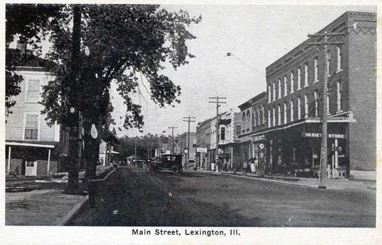
For two decades the original two-lane road ran straight through the center of town. Gas stations, at least nine of them at their heyday, lined the route through Lexington. By 1946, the neon LEXINGTON sign lit up the corner of Old Route 66 and Main Street welcoming travelers making their way across the country, usually heading west in those days.
The Road That Got Left Behind
Progress, as it tends to do, eventually bypassed the old road. The demands of wartime traffic in the 1940s and the postwar automobile boom made it clear that the original route could no longer handle the volume. By 1947 the path that is now Memory Lane had lost its Route 66 designation, and when Interstate 55 opened in 1977, even the new four-lane bypass fell quiet. The last car to use the original Lexington alignment as a through-route turned off in 1978. By the 1980s, the original road had been blocked off as the concrete slowly cracked and began to return to the prairie flora.
It might have disappeared entirely, as so much of old Route 66 has across the country, had the community not intervened.
Preserving the Pavement
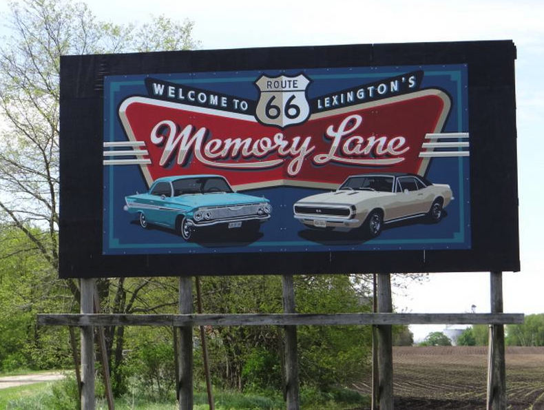
In 1990, Lexington took decisive action to save the original roadbed, formally preserving it as "Memory Lane." The stretch runs for nearly a mile along the original 1926 roadbed, entering Lexington from the north and it is one of the very few places in the entire state of Illinois where travelers can walk on the authentic pavement of the first Route 66. The one-mile stretch has been restored to a 1940s-era appearance, complete with vintage billboards and Burma Shave signs.Memory Lane is open year-round to pedestrians and cyclists, offering a quiet, shaded walk that feels removed from the noise of nearby highway traffic. During Lexington's annual Route 66 Red Carpet Corridor celebration in May, the lane opens to vehicular traffic, allowing vintage automobiles to roll once more over the same concrete that carried travelers westward in the 1930s, 40s, and 50s. A picnic and parking area along current Old Route 66 provides a natural starting point for the walk, with signage connecting the landscape to its layered history.
The Signs That Tell the Story
Three sets of vintage billboards along Memory Lane help recreate the nostalgia of the golden era of American road travel.
The Burma-Shave signs are perhaps the most recognizable. Burma-Shave was a shaving cream company founded in the 1920s, that made its way into the cultural milieu of the mid 20th century with its little billboards, posting silly poems and rhymes on small sequential highway roadside signs.The gimmick was devised by the son of Burma Shave’s founder, who noticed sequential roadside signs pointing to a gas station and thought they would hold the attention longer than the average billboard. In 1925 Burma Shave doubled down on the plan and invested upwards of $25,000 a year in small sequential billboards around the country (driving company growth, shooting their revenue up to nearly $69,000 a year). The signs were painted red and white to stand out, placed in sets of six, each 100 feet apart; spaced so passengers had about three seconds to read each one at a speed of 35 miles per hour. At their peak, 7,000 Burma-Shave signs stretched across America, and they became, for a time, as much a part of the American landscape as cattle, corn, and cars.
The signs were discontinued and mostly taken down in 1963 after the company was sold. But their time had come. Faster cars, more traffic, and the expanding interstate system made the small sequential signs too difficult (and dangerous) to read on these faster-paced roadways. While the only full original set of Burma Shave signs are in the Smithsonian, the reproduction signs on Memory Lane recreate that lost piece of once ubiquitous, now extinct, popular culture.
The Nehi soda billboard is another road-trip staple from a forgotten time. Nehi cola was introduced in 1924 by Chero-Cola/Union Bottle Works, founded by Claud A. Hatcher, a Columbus, Georgia, grocer. The name "Nehi" reminded customers that the soda came in "knee-high" tall bottles. The distinctive 12-inch glass containers towered over the smaller bottles of their competitors. Sales of Nehi sodas surged from 1924 to 1928, growing from 10,000 cases per year to over 600,000 cases annually, and Hatcher rebranded his entire company as the Nehi Corporation in 1928 based on the popularity of the grape, orange, and peach flavored sodas. Eventually, Nehi found more success with their Coca-Cola competitor RC Cola, and in 1955, they renamed the company after that successful beverage. You can still get RC products, including RC Cola, at Kemps Upper Tap in Lexington. While today soda is still consumed and enjoyed, its power in popular culture crested in the early/mid twentieth, but on Memory Lane you can still see the high water mark of soda’s impact on American culture.
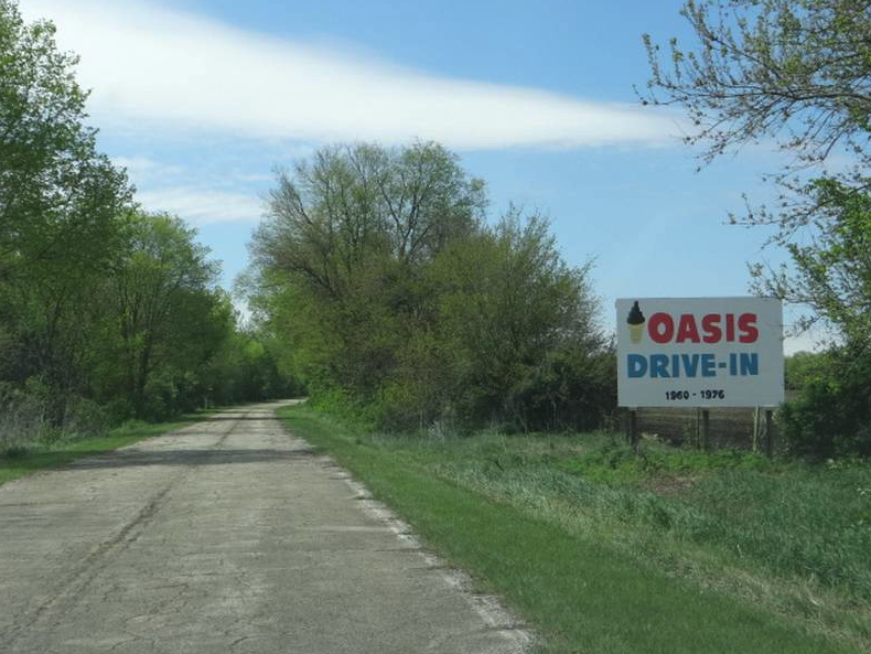
The Oasis Drive-In billboard is the most local billboard featured on Memory Lane. This roadside sign is a relic from a Lexington institution that once sat at the junction of the original and four-lane Route 66 alignments, just south of town. The Oasis Drive-In was built by Elmo Winterland in 1960 and operated by Elmo and Arline Winterland as a classic American burger-and-shake spot. On a Friday or Saturday night, the spot would be packed with local teens (and adults!) enjoying a burger and milkshake, including the beloved "Luigi Burger" with its special sauce. As you drive by the abandoned but still standing Oasis today, you can imagine a busy late 1950’s evening with the era's muscle cars parked under the drive-in's sleek modern canopy and the hustle and bustle of postwar American life.
The Oasis closed its doors in the mid-1980s, but its legacy endured: in 1998 it was inducted into the Route 66 Association of Illinois Hall of Fame.The original sign still stands on South Grove Street, a rusting monument to Lexington's heyday on the Mother Road.
A Living Landmark
Memory Lane is a physical record of how Lexington grew and changed from a frontier waystation on an unpaved cattle trail to a thriving stop on the most famous highway in America. Today, Lexington is in the midst of another change, fighting the widespread decline of the American rural landscape and becoming again a thriving community full of strong local businesses and institutions.
Whether you arrive by bicycle, on foot, or simply pull over to read the signs and breathe the prairie air, Memory Lane offers something increasingly rare: a place where the past hasn't been paved over, but instead preserved one carefully tended mile at a time.
-
Memory Lane is located off Parade Road at Old Route 66, on the north side of Lexington, Illinois. Free and open year-round.
All Lexington History Project articles were written and edited by Nicholas Rynerson and Elizabeth MacPhail, with research and editorial contributions from THE FORT Historical and Genealogical Society in Lexington, Illinois.
A Note on Citations: All non-cited facts, dates, and addresses were provided from the archives of THE FORT Historical and Genealogical Society in Lexington, Illinois. For any additional information on specific town history, email THE FORT at thefortoflex@aol.com. For any suggested chronological changes regarding the information in this article please email nick@bolt-cutter.com.
Find All the Articles Around Town
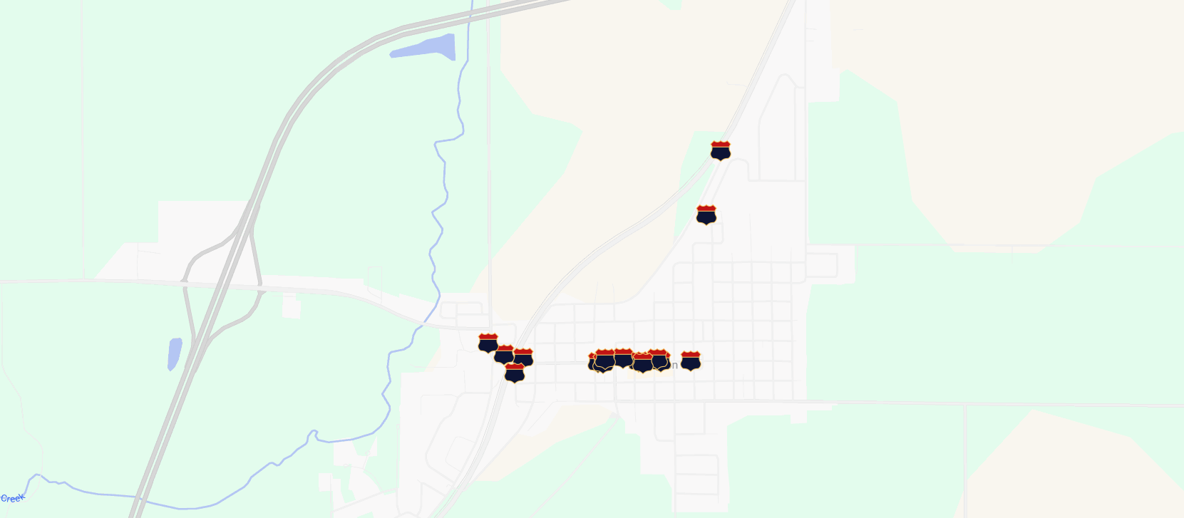
Click through the custom Google Map below to find all of the Lexington History Project signs and articles placed around town.
Presidential Visits. Supreme Court Cases. Railroads. Route 66.
Established in 1836.