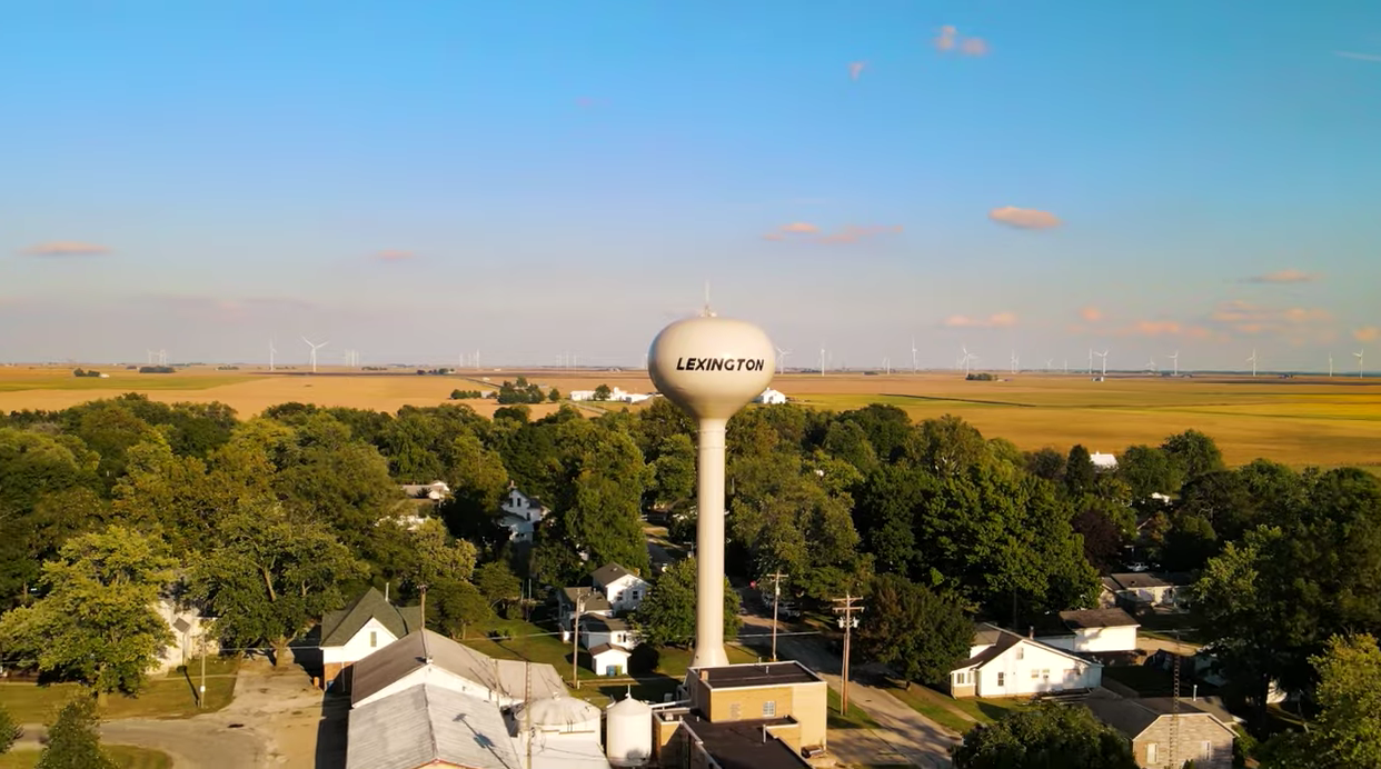
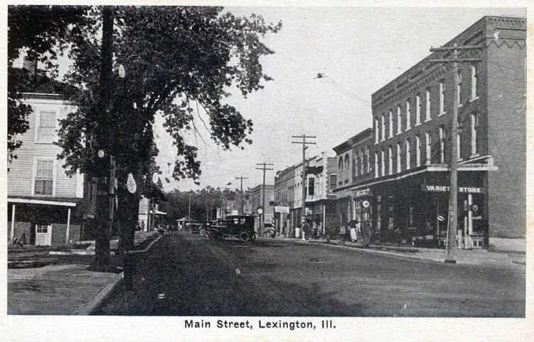

Taking It Easy: “The Square” and Other Parks of Lexington
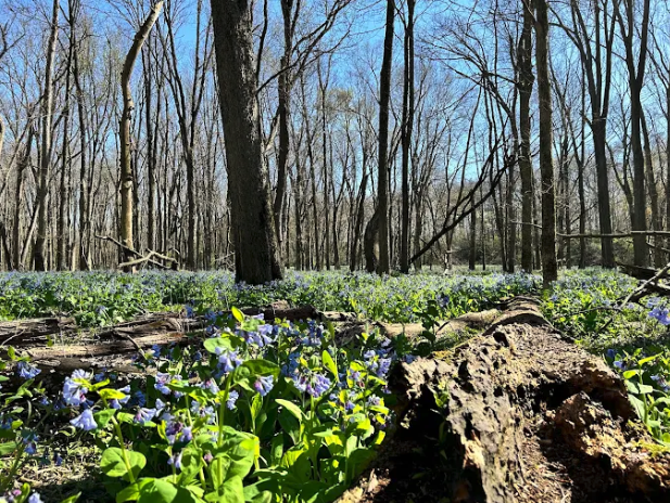
The Bluebells at Merwin Nature Preserve, Circa: 2025, Source: Parklands Foundation
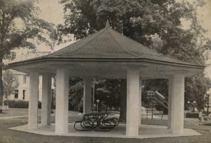
Circle Park Pavilion, Circa 1960, Source: The Fort
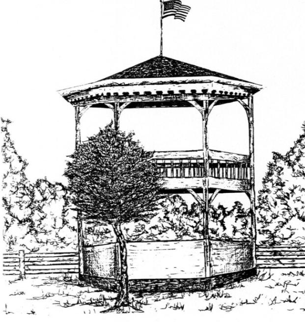
Lexington Bandstand Illustration, Circa: 1870, Source: THE FORT
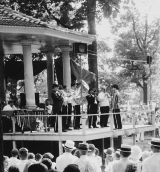
No good photo of the Lexington Bandstand has been found, but this photo from Miller Park in Bloomington shows the bandstand built in the same era by Mr. Clark Stewart in the same pattern as the Lexington bandstand
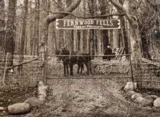
The Entrance to Fernwood Fells, Circa: early 1900s, Source: THE FORT
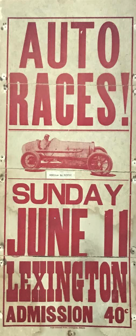
Lexington Auto Races Poster, Circa 1930s, Source: THE FORT
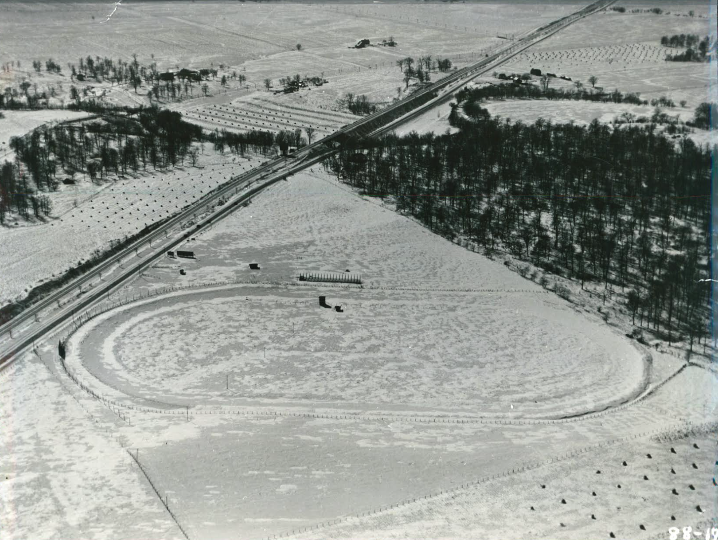
Lexington Speedway, Circa: 1940s, Source: THE FORT
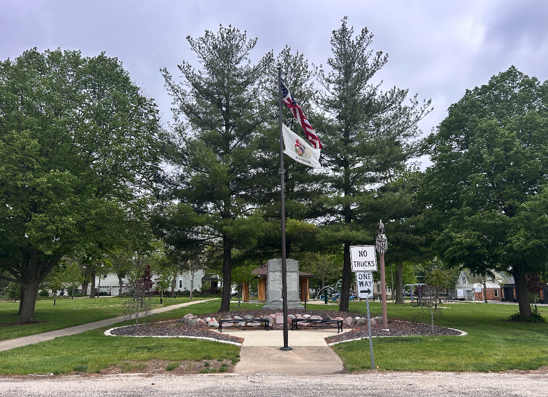
The War Memorial at City Park, Circa April 2026, Source: Nicholas Rynerson
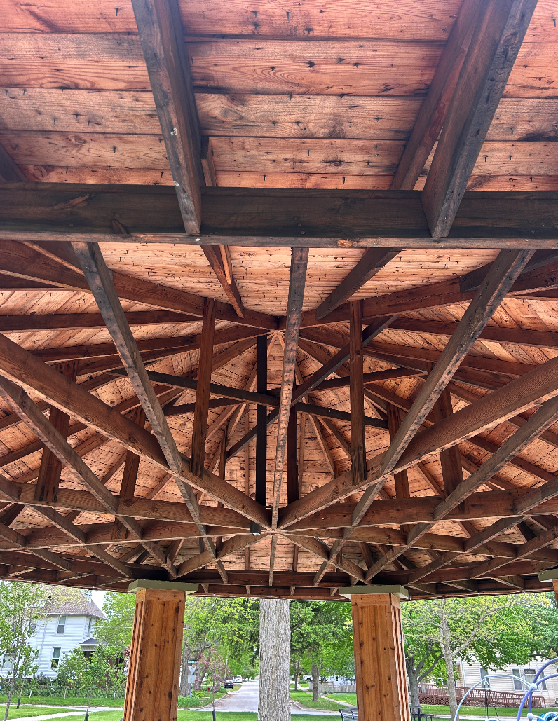
The Roof of the Pavilion at City Park, Circa April 2026, Source: Nicholas Rynerson
Taking It Easy: “The Square” and Other Parks of Lexington
A Park With Many Names
The Square, City Park, Lindsay Park, and Circle Park are all names for the same center spot that was laid out in 1836 by Gridley and Brown when they platted the town of Lexington, Illinois, between North, South, East and West Streets into 32 lots around a central square block intended to serve as the heart of the town.
In that layout, common for Illinois settlements at the time, among the rows of streets there sits a conspicuous grassy square in the middle of the layout. This little square has served as a gathering place for Lexington residents since the very beginning. Today, you’ll notice a smattering of trees, some young and some tall and old, a modern playground, a War Memorial, and a pavilion. This pavilion, in particular, has hosted generations of Lexington events and celebrations.
In the mid-19th century, a Mr. Lindsay lived around the circle of Lexington Park. Lindsay would graze his livestock around the grass square and first planted the trees around the park, some of which still stand today.
In the early agrarian days of central Illinois, these parks laid out at the center of the town were essential for grazing and sometimes even would produce a crop of hay. As Lexington grew and the needs of the community changed, this park would become a fixture for public community life.
A Bandstand In The Heart of Lexington
It’s hard to overestimate the American love for band music in the 19th and early 20th century. Bands were a big deal; Lexington residents would look forward to seeing the local band perform on the bandstand the same way modern residents look forward to local sports games and Main Street festival days. Lexington had (and still has, for those in the loop) a reputation for excellent band music. This culture of band music was accompanied by the Lexington Park bandstand, a high wooden platform and structure where the current gazebo sits. This bandstand was a fixture in the park from Civil War days until 1960. This rise and fall of the Lexington park bandstand closely tracks with the rise and fall of band music’s cultural dominance.
The drawing of the two-story stand in the middle of the park was from an 1870 photo showing the Lexington city park decorated for a political meeting day. It’s here at the bandstand that local and regional politicians would make their appeal to local voters, folks would gather for picnics on warm days, and where the heart of local (band concerts) entertainment would take place.
The Lexington Cornet Band consisted of local amateur musicians who made the band a popular attraction at many area events. Concerts in the Lexington city park were held regularly as social events not to be missed. Through the years, several ordinary bandstands were erected and used by the musicians who entertained the townspeople. Not many details or information was recorded about the early structures, but a bandstand always seemed to be a part of the Lexington city park.
The final bandstand was the 1924 Lexington bandstand. Built by a Bloomington music patron, Clark E. Stewart, it was the third stand he donated in McLean County (after the first at Miller Park in 1911 and then in Leroy in 1922). The foundation was made of rough, broken stones laid edgewise in red cement, some blue in tint, some gray, and some red, making a mosaic effect. Mr. Stewart procured these rocks from the Mackinaw with great difficulty. The bandstand was octagonal in shape: 22 feet across with 16 posts that held up the pagoda-type roof. The entire height was about 24 feet, with broad steps to the west, and a circle of lights under the roof. No good photo of the Lexington structure has been found, but a photo from Miller Park in Bloomington (above) shows the bandstand built in the same era by Mr. Clark Stewart in the same pattern as the Lexington bandstand he donated in 1924.
In August of 1960, the wooden floor of the 1924 bandstand had rotted, and other repairs were needed; city leaders noted that the old bandstand had not been used regularly for 25 years. They were reluctant to part with the unique octagon roof, so they lowered it to 8 feet 8 inches and converted the stand into a shelter with a concrete floor and concrete block columns to support the eight-sided roof.
A cornerstone strongbox was found during the rebuild that contained lists with names of the musicians of all four of Lexington’s previous bands from Civil War days, 1875, 1884, and 1925. The previous contents, plus a current list of city officials and a few news clippings, were planned to be sealed into one of the new pillars.
The Circle Park Today
In 2015, the city began to plan for needed renovations in the city park. As of 2026, the plan is ongoing.
New landscaping around the Unknown Soldier Memorial on the west end of the park was the first part of the project and was completed by Lexington landscaper Joe Bennett. The previous berm was obstructing the view into the park, so it was cut back a bit. A new patio with two backless benches was placed before the memorial marker, and new plants were set in along with new edging. The two weeping red buds were planted in this area to honor Lexington residents Danny and Pam McDaniels.
Annually, since 2016, a fundraiser “garden walk” directed and organized by volunteer Lucy Loper and Lexington gardeners has provided funds for memorial trees to gradually restore the park’s grove of trees (originally planted by Mr. Lindsay). The garden walk fundraisers have planted at least 20 new trees in the park as of 2025.
Recently, a memorial tree was added near the new playground to honor Mayor Spencer Johansen’s brother Charles, a who passed away at age 20, and an aspen tree was put near the center of the park where the sidewalks cross to honor the memory of Bob Wahls, another prominent Lexingtonian.
In 2025, the City Council held a winter fundraiser to finance new playground equipment planned for the city park. When the equipment arrived, installation day involved several volunteers and city council members working in a marathon to get the new playground done in just a day. The organization of that project was handled by Mayor Spencer Johansen and City Hall office administrator Star Torkelson.
Mayor Johansen pushed the pavilion renewal project forwar d in 2025. Local contractor Tom Stacy and his crew dug out the old concrete and repaired the base of the pavilion. While the concrete work was in progress, volunteers began removing the rotted beadboard ceiling of the original roof. When antique red oak hand-hewn octagonal beams were revealed during the teardown, the city council decided it would be best to leave the ceiling open so people could appreciate the 100-year old master carpentry. Cedar boards were added to the pillars to complement the roof beams.
PJ Keller Park
Today, much of the community’s outdoor recreation and team sports takes place at PJ Keller Park, a sprawling green complex on the north side of Lexington. Keller Park encompasses 24 acres (23 acres larger than Lexington Park) and is home to the Lexington public pool, lighted tennis/pickleball courts, an athletic complex complete with baseball diamonds, softball fields, basketball courts, soccer fields, a modern playground, a volleyball pit, and large picnic shelters all encompassed by a walking trail.
The Patton Cabin was moved to Keller Park from its original location for easy access and preservation. Keller Park hosts baseball and softball tournaments, school practices for various sports, youth leagues, and the occasional historical reenactment at Patton Cabin.
Merwin Nature Preserve
Spanning over 700 contiguous acres of diverse native habitats and scenic bluffs, the Merwin Preserve is the flagship of the ParkLands preserve system (headquartered in Normal, Illinois). Featuring miles of hiking trails along the Mackinaw River, Merwin is a hotspot for hikers and birdwatchers from all over, as well as Lexington residents looking to get out into nature.
Every Spring, the lowlands near the Mackinaw River are covered by acres of bluebell flowers that sprout on the ground between forest trees. For the bluebells brightest display, plan a trip to Merwin in late April or early May.
A Community of Parks
While the park at the center of town has been at the center of Lexington life for nearly 190 years, Lexington has seen many parks come and go, from Fernwood Fells, a 43 acre timber park which was called “The Garden of Eden of McLean County” by a local writer to the Lexington Motor Speedway developed by James Van Dolah and other Lexington businessmen that hosted widely attended automobile and motorcycle races in the early 20th century. The parks have changed as the city has changed, but the desire to be outside in a beautiful place surrounded by grass, trees, and other Lexingtonians is still going strong.
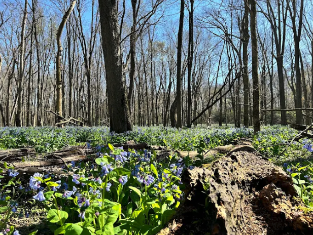
(The Bluebells at Merwin, source)
BONUS: A TIMELINE OF LEXINGTON PARKS (Compiled by THE FORT)
1800’s -Scrogin Pasture/Dawson Park/Harness Park
Comments from “old timers” tell that for many years locals used the Scrogin pasture north of town for outdoor team activities of a physical nature – baseball, football, running, wrestling, and the like. With the Scrogin generosity in allowing neighbors to use the same hillside for burials, a new playground was soon discovered at the SW corner of West and South Streets. The land on this corner at various times belonged to both Harness and Dawson relatives, so the grounds were known by both names at different times.
In spring and summer the area hosted lively baseball games, in fall it became a football field, in winter the city flooded a spot for ice skating, along with any time picnics, reunions, political rallies, holiday celebrations, fireworks, circus tents, or any city event that needed lots of open room. A ticket booth, fences, a grandstand erected by city merchants were all improvements that stood on the property for years and the spot was often fondly remembered as folks shared memories of their youth in Lexington.
1870s - Lexington Driving Park
Lexington Driving Park was owned and developed by Dr. J.W. Waters on a multi-acre plot at the
east end of Main Street stretching to South Street in the days when “Horses were Kings” in Lexington in the early 1870s. Lexington Driving Association staged an annual fair on the grounds each fall beginning in 1879 and continuing through the turn of the century. As described in the news, “There is perhaps no other city of this size anywhere in the West that affords such a magnificent Driving Park as that which Lexington proudly possesses.
This beautiful park is situated on the eastern outskirts of the city at the extreme east end of Main Street with a grandstand and barns on the property. The grounds have lately undergone extensive improvements, and the track has been made into a regulation half mile course and is as level and smooth as a floor. This track is as true and perfect as surveyors and workmen can make it and adds greatly to the uncommon attractions of the city. The magnanimity of the promoter is worthy of emulation and the beneficent results from this excellent Driving Park can be seen in the development of Lexington’s almost unequalled driving and trotting horses.” Locals were privileged to use the park to train their horses, if they closed the gates when they finished.
Baseball games were also enjoyed from the stands of the Driving Park as noted by scores in the news of the 1890s. Dr. Water’s nephew, S.R. “Dick” Waters, an architectural engineer, designed upgrades for the racing track in 1892 to benefit the many fine horses in training in this area.
The first “FIELD DAY” (track meet) for Lexington school was held at this park in 1897 with contests in jumping, vaulting, throwing the hammer, putting the shot, throwing balls, running, walking, dexterity, strength, skill, speed and endurance. With the smooth track and filled grandstand it was noted as a fine day for all.
George Dement,Jr. served a time as manager of the park as did Charles Wilson after the death of Dr. Waters in 1898. T J Kent, with interest in raising horses and racing, served as the last manager of the park in the early 1900’s, but as mechanics replaced the horse for work and transportation in the early 1900s the park lost much of its usefulness and eventually, Lexington Driving Park became only a Lexington memory.
1880s - Fernwood Fells: The Garden of Eden of McLean County
Fernwood Fells was a 43-acre park in the timber southeast of Lexington just off of “Deer Road” owned and shared by G. J. “Jake” Smith. Fernwood Fells was once described by local author Morris W.
Jones as “The Garden of Eden of McLean County, with the scenic Mackinaw River to the south, forever flowing toward the Illinois River, forming a beautiful panorama that only God could create.” The cool atmosphere of Fernwood Fells attracted local and area people, with the hot afternoons of the summer months frequently passed in rest and quietude in Jake Smith’s timber. On occasion, this pristine woodland area was also used by groups from Lexington High School, area churches, local clubs, and even some from Illinois Wesleyan University for both formal and informal gatherings.
Jake erected a log cabin in his timber and placed skins, trinkets, novelties and other articles to attract the eye of the many people who found this park an ideal place for picnic fun in the late 1800s and early 1900s. Over the gateway was a huge log on which was inscribed the name of the grounds, FERNWOOD FELLS.
The timber was virgin and unharvested in those days, with only the underbrush being cleared away for human comfort.
G. J. Smith passed away in 1927, and the park area was eventually sold in 1934 to be used as a lumber camp to harvest most of the useful timber. An article in the Chenoa Clipper Times in August, 1930 stated that “the members of the Lexington Club who recently purchased a lot at Lake Bloomington have secured the cabin, once famous in Fernwood Fells, and have moved it to their site, where it will become the scene of many happy occasions.” It seems the cabin was destined to live on for some years after the closure of Fernwood Fells on Deer Road southeast of town.
1890 - Spring Bluff Park/VanDolah Park
L.S. Van Dolah, the youngest son of Britannia and David Van Dolah, created Spring Bluff Park seven miles west of Lexington along the Mackinaw River in Money Creek Township. The park was on the banks of the Mackinaw with hills and ravines and even springs to make the place realistic and enjoyable and it was through his kindness and affectionate temperament that all people of the county were permitted to enjoy the park for years.
The park was half a mile from the road with virgin timber on all sides. The Mackinaw meandered to one side and, on the crest of a hill, stood an ancient log cabin, probably once occupied by some early settlers. Van Dolah repaired the cabin and made improvements to entertain his many friends, like swings, chairs, bridges, and pens for horses, all rustic in character. The logs and timber were taken from the forest nearby, the pieces chosen carefully by Mr. Van Dolah. The bridge was 148 feet long, rustic in its appearance. Birdhouses and small seats were built and scattered around near the riverbank, and there was also a natural spring bubbling up from the ground, as free as the air, clean, wholesome, and cold.
Near those springs Mr. Van Dolah built a refrigerator of rocks and concrete, with water being s”o cold that food placed there would keep as long as if placed on ice”. This cabin, which he named the Do Drop Inn, contained chairs and a huge fireplace with a big Dutch oven for cooking. The walls were hung with animal skins and pictures of earlier days to give it a restful and welcoming feeling.
According to a 1914 article, Many people visit this spot, not only from Bloomington, Lexington, and other McLean County points, but from the state at large, and even other states. So popular has this place become from an eating standpoint that a complete set of dishes is kept in the rustic cupboard, ready for use at any time, and it is said that Mr. Van Dolah also kept two small boats tied there for the use of visitors and pens for horses used to bring carriages and visitors to the site.” Van Dolah’s Spring Bluff Park was a wonderful place for the visitor. The popular park was located on the bank of the Mackinaw River very near what is now the NE corner of PJ Keller Hwy and the Gridley Road. Over the years the park changed drastically, but the grounds are still preserved as the first parcel that started Parklands Foundation, and we still have the memories recorded by those lucky visitors who enjoyed Van Dolah’s Spring Bluff.
1890s Best Park
Jacob Best, lumberyard owner and community-minded Lexington citizen, proposed in 1898 to donate land he owned near the Mackinaw River for a city park. The following are his stipulations for turning over the grove to be used as a park:
“Mr. Best to name the trustees {to act without compensation} while he is living; that the sale or giving way of intoxicating liquors be strictly prohibited on the grounds; that there be no gambling devices on the grounds; that stock shall not be allowed to run at large in the park; speeding horses on the park drives shall be prohibited. All live timber shall be left the same; all timber in the bottom of the lake shall be grubbed out; that the park shall be cleared of stumps and the holes filled up; that there shall be at least two main entrances into the park; Mr. Best and family to be entitled to a free pass to the park always; all gate receipts shall be devoted to park improvements; that a special effort be made to get a flowing well near the upper end of the lake, and a windmill shall be built.” The land Mr. Best proposed to donate was a piece of undulating timberland bounded by the C & A Railroad, Mackinaw River, Dawson’s timber, and the Bloomington wagon road. Mr. Best agrees to deed this to the people if all of his provisions are met and that $3,000 be raised for the purpose of making the improvements necessary.”
No one doubted at the beginning that this $3,000 would be raised, and the park would be “a sure thing”. It was voted to thank Mr. Best for his offer. Even though nothing remains today that marks this spot as a city park, there were many references to the area was called BEST PARK between 1898 and 1920s and the last mention in the news was in 1938.
The news said that Best Park was used by school classes, churches, and organizations for gatherings and picnics. John Haushalter told in a news story in 1947 that his family rented the area as a pasture when he was a young man learning the grocery and meat market business, with their slaughterhouse and
yards near the bridge.
1920s - Franklin Grove
Another community-minded family turned their timber ground near the Mackinaw River into a park of sorts for Lexington folks to enjoy. Since the earliest days of Lexington, Noah Franklin farmed on his land just west of Lexington and news of gatherings at his country home often told of how many enjoyed time in his large grove near the Mackinaw. Through the years this retreat has entertained many noted and not-so-famous guests, with one picnic in July 1920 planned for 5,000 but nearly 10,000 came to enjoy the BBQ beef, which took nearly 4 hours to serve. The grove is still preserved as a treasured spot near Lexington.
1920s - Camp Ta Ta Pochon
In the 1920s the Boy Scouts traveled to Lexington for camping experiences along the Mackinaw River and their name for their camp was from the Indian language.
Over the years they returned annually for camping trips and learning. In 1928 they honored Noah Franklin by officially renaming the camping site Camp Franklin.
1925-1935 Lexington Motor Speedway
Developed by James Van Dolah and other Lexington businessmen on Van Dolah property just north of the Mackinaw River and next to the new Route 4/Route 66 at Lexington. Drivers and spectators came from across the country to watch races on the half-mile track that was touted as the best to be seen. A judges stand, fencing, and grandstands along with curtains to discourage watching from the hard road, were installed over the years. Weather played its part in cancelling many of the planned races, and after 10 years of excitement, the park closed to the disappointment of many.
1922 – 1934 - Turkey Creek Golf Club
A nine-hole golf course on twenty acres was designed and built on the banks of Turkey Creek just south of the Lexington Cemetery. Thirty chartered members were excited to join together for this local club that even had a clubhouse that still stands opposite the cemetery entrance on PJ Keller Highway. Games and social get-togethers were events that local golfers enjoyed for many years.
1880’s – 1944 Swimming Holes: Hilda’s Hole on Mackinaw & Corbett’s Hole on Turkey Creek
The “old swimming holes” of Lexington are now known only through limited newspaper clippings and the memories of young swimmers, now grown. Not much is known about the Turkey Creek hole except the name, but Hilda’s is memorialized by its demise. A newspaper notice in 1887 warned everybody to “keep out of Hilda’s Hole on the Mackinaw” but it was still a popular cooling-off spot until June 1944. On a day in June 1944, kids were swimming and a man was fishing when cries for HELP rang out. Young James Prewitt was in too deep, and the just-home-from-war veteran Roy Rouse tossed his fishing pole aside and went to the rescue. Sadly, both James and Roy perished. The makeshift dam, holding the Mackinaw water back and making it deep enough to swim, was destroyed that afternoon so they could recover the bodies.
1950’s - Schultz Maple Park
Schultz Maple Park is remembered fondly as a place to go fishing and get maple syrup at the old Best Park off of West Street near the Mackinaw Bridge. They sold trees and made fresh maple syrup each year.
1960’s PJ Keller Park
This park was developed to provide more area for school activities when the football field and baseball diamond were moved from the school lots between Center and Cherry to the area north of Chatham Street and east of Cherry Street. In 1965, the Patton Cabin was restored and eventually placed in Keller Park. Over the years swimming pools were added along with facilities to accommodate tennis, little league baseball and football, soccer, play equipment, pavilions, restrooms, etc. Many acres were added to make the present park the largest in the city.
1980’s - Stitcher Park
This small park at the north end of Memory Lane was donated when Memory Lane was refurbished for the Taste of Country Fair by the Stitcher Family, who used to have a pony farm next to Route 66. The Stitcher Park is still available for picnics and bird watching, with a collection of cute bird houses made by Lexington students and hung around the park. There is a pavilion for shade on a sunny day.
1985 – Route 66 Park
Route 66 Park surrounds a large oak tree that stood next to Route 66 for so many years, where the city designated this small area of wasted space as a park at the entrance to Main Street, across the road from the famous LEXINGTON Neon Sign. The Lexington High School history club purchased and erected the state marker bronze sign telling the Route 66 history (the only such sign in the state of Illinois) and the 2020 American Standard elephant statute found it’s home here, too.
All Lexington History Project articles were written and edited by Nicholas Rynerson and Elizabeth MacPhail, with research and editorial contributions from THE FORT Historical and Genealogical Society in Lexington, Illinois.
A Note on Citations: All non-cited facts, dates, and addresses were provided from the archives of THE FORT Historical and Genealogical Society in Lexington, Illinois. For any additional information on specific town history, email THE FORT at thefortoflex@aol.com. For any suggested chronological changes regarding the information in this article please email nick@bolt-cutter.com.
Like this article? Download a PDF
Find All the Articles Around Town
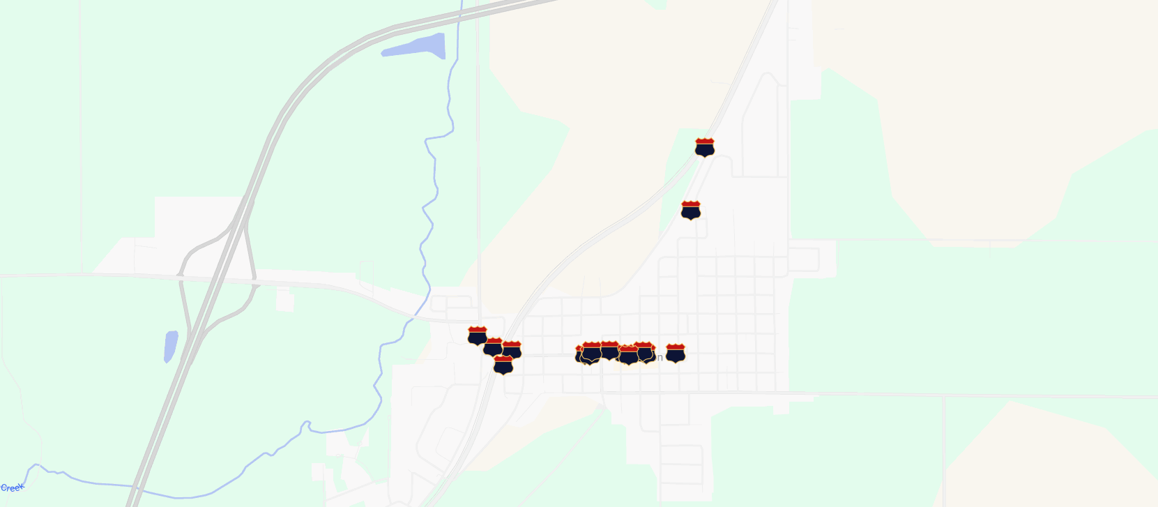
Click through the custom Google Map below to find all of the Lexington History Project signs and articles placed around town.
Presidential Visits. Supreme Court Cases. Railroads. Route 66.
Established in 1836.